Key takeaways
- Madeira's south coast is largely vertical rock, and the scale of it only registers when you are looking up from sea level.
- The city fills a bowl of hills rising from the harbour, a shape that is invisible from inside it and obvious from the water.
- Cultivated steps cut into slopes too steep to farm otherwise climb the hillsides until the gradient finally beats them.
- The interior traps weather, so a clear coast below a capped summit is one of the most reliable sights of the trip.
Why the coast reads differently from the sea
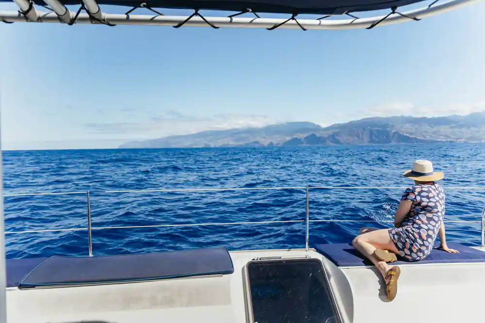
Driving the coast road, you get glimpses: a view over a wall, a valley, another tunnel. The scale never assembles, because you are on the thing you are trying to look at. From a boat a kilometre out, the whole south face of the island is in front of you at once and the proportions become clear.
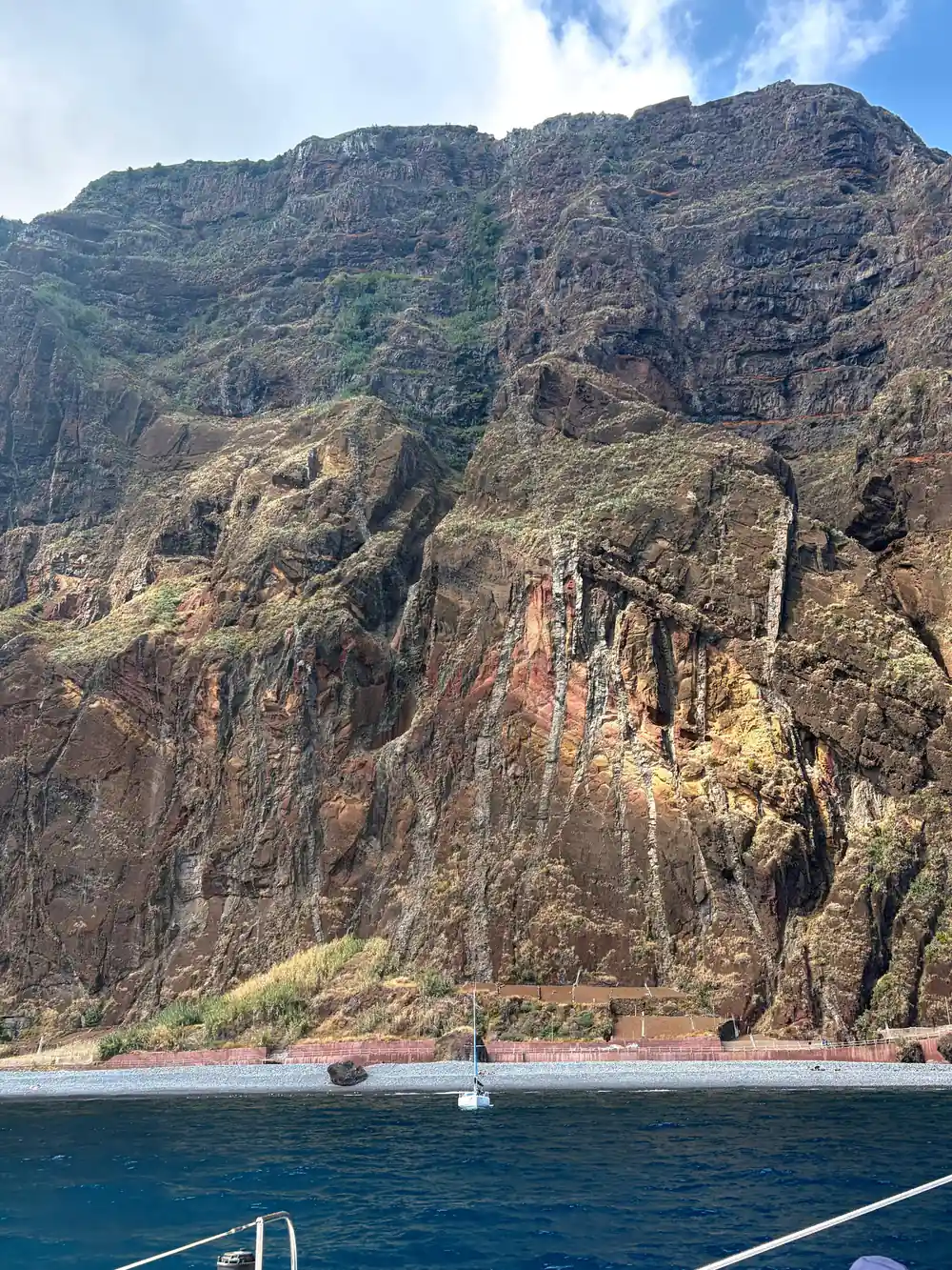
What you see is a wall. Madeira's south coast is substantially vertical, with rock rising hundreds of metres straight out of the water and only occasional breaks where a valley reaches the sea and a village has been built into it. It is closer in character to a fjord wall than to a Mediterranean shoreline, and it is the reason the boat trip is worth taking even on a day when the animals are shy.
The cliffs themselves
Look closely and the rock is layered, in bands of different colour and texture stacked one on another. Each band is a separate volcanic event: a lava flow, an ash fall, another flow on top of it, built up over hundreds of thousands of years and then cut back by the Atlantic into the face you are looking at.
Cabo Girao, west along the coast, is the most famous of these faces and one of the highest sea cliffs in Europe at 580 metres. But it is not alone. The whole stretch is punctuated by headlands and faces of comparable drama, and from the water you get them in sequence rather than one at a time.
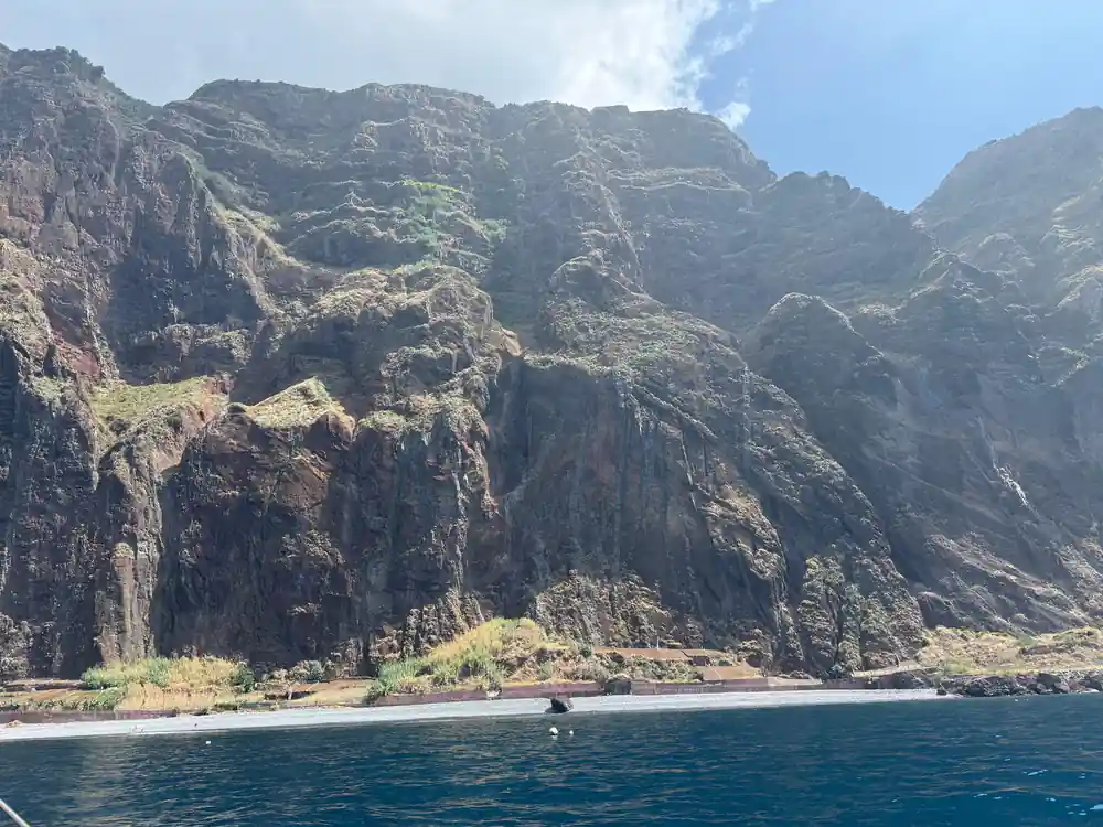
The layered volcanic cliffs of Madeira's south coast seen from the water
Funchal as a bowl
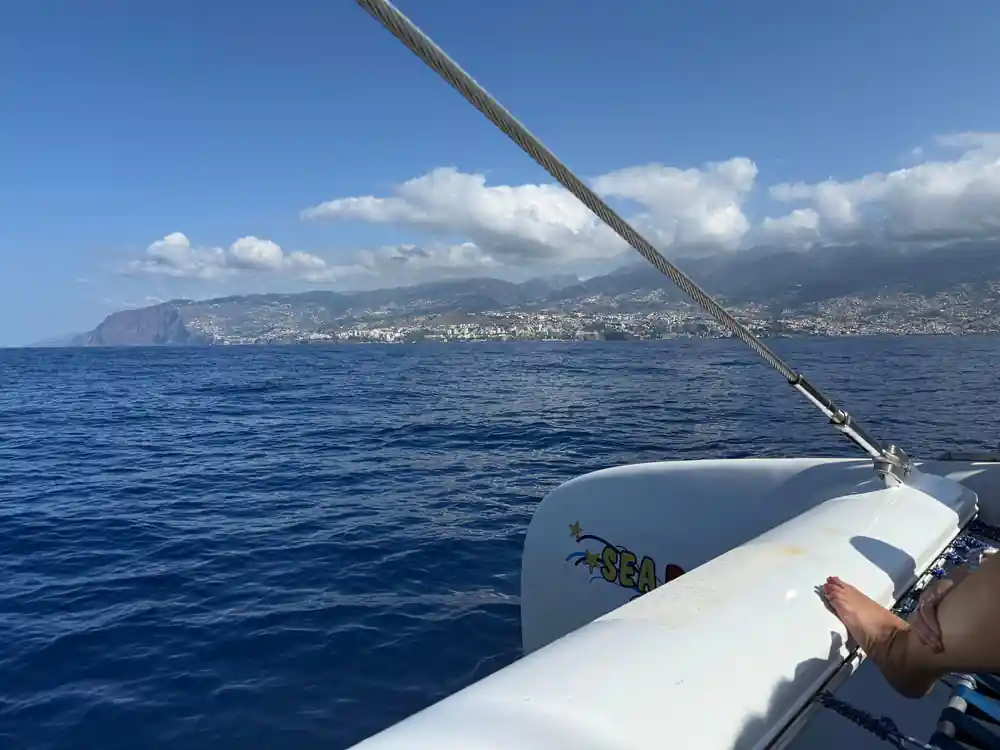
The city itself only makes sense from out here. Funchal is built into a natural amphitheatre, a bowl in the mountains opening to the sea, and from within it you cannot see the shape because there is always a building in the way. From the water the whole thing resolves: the harbour at the bottom, houses climbing every slope of the bowl, and the ridgelines closing it at the top.
You can pick out the cable car running from near the old town up toward Monte on a clear day, and the working port at the eastern end where the cruise ships berth. Guests describe this as the moment the city made sense to them, and it usually comes on the way back in when there is nothing else to do but look.
The terraces
Above the buildings, the slopes are stepped, and once you notice it you cannot stop seeing it. These are poios, agricultural terraces cut into hillsides far too steep to farm any other way, each one a level shelf held up by a dry stone wall.
They are how an island with almost no flat ground fed itself for centuries, and they climb astonishingly high. Bananas grow on the warm lower terraces near the coast, vines further up. From the sea you can trace them running up the hillside until the gradient finally defeats them, which on some slopes is a very long way indeed.
1,818m
The height of Pico Ruivo, Madeira's summit, which stands behind the coastline you are watching from a few kilometres offshore.
Villages in the gaps
Where a valley does reach the water, there is usually a settlement in it, wedged into the only flat ground for kilometres. Camara de Lobos is the best known, a fishing town in the next bay west of Funchal with painted boats drawn up on the shingle and a harbour that Churchill sat and painted in 1950.
These places are worth looking at properly because they explain the island's geography better than the cliffs do. People live where a river cut a gap, and nowhere else, which is why Madeira's settlement pattern is a string of separate places rather than a spread.
The mountains behind
On a clear day the interior stands up behind everything else, and it is worth deliberately looking past the coast to see it. Madeira is extraordinarily steep for its size: Pico Ruivo, the summit, reaches 1,818 metres within a few kilometres of the sea, and the high ground around it is barely lower.
That relief is also the island's weather machine. Cloud piles against the high ground and frequently sits there while the coast stays clear, which is why you will so often see a bright shoreline below a capped ridge. It is one of the more dependable sights of the return leg, and it explains why the north of the island is green rainforest while Funchal sits in sunshine.
The light
Madeira is at the latitude of Morocco with clean Atlantic air around it, and the light is correspondingly strong and clear. Middle of the day is flat and the cliffs read as a pale mass, but the water is at its bluest with the sun overhead, which is when the swim stop looks its best.
Later in the afternoon the sun swings west and lights the south coast face-on, and that is when the terraces cast enough shadow to show as steps and the rock picks up its colour. If you have a choice of departure time and the coastline appeals to you as much as the animals, the later trip is the better one for looking at it.